The post Detecting Data Center Construction Through Real-World Mobility Signals appeared first on INRIX.
]]>For investors, developers, and infrastructure strategists, the challenge is no longer identifying where data centers exist. The real advantage lies in understanding when projects begin, how quickly construction is progressing, and what stage of development a facility has reached.
Traditional indicators such as planning permits, press releases, or quarterly disclosures, often lag real-world activity by weeks or even months. The earliest signals of infrastructure development often appear in the physical world: trucks delivering materials, construction crews arriving on site, and supply chains mobilizing to support large-scale projects. By combining INRIX mobility intelligence with Spatial Risk Systems’ (SRS) asset-level infrastructure analytics, investors can detect early infrastructure signals long before traditional reporting captures them.
Fusing Powerful Signal Sources
The collaboration between INRIX and SRS brings together three powerful data foundations:
- INRIX: Provides the world’s largest real-world movement dataset, capturing how people, vehicles, and freight behave across global road networks every hour of every day.
- SRS: Delivers precise, structure-by-structure exposure mapping that connects physical assets to their owners, operators, and publicly traded entities.
- Trip-to-Journey Data Science: A proprietary methodology that transforms commercial truck movement data into underwriting-grade supply chain intelligence, giving institutional investors independent visibility into facility activity and physical capital flows across their coverage universe.
Together, these capabilities transform raw mobility signals into actionable infrastructure intelligence.
The Challenge: Timing and Risk in Data Center Investments
Building a data center is a high-stakes undertaking. Individual facilities frequently cost hundreds of millions of dollars and can take years to complete. Investors and infrastructure analysts must answer several key questions:
- Which companies are building new data centers?
- Where exactly are these facilities located?
- How quickly is construction progressing?
- Which projects may be delayed or accelerating?
Traditional sources of information often fail to provide timely answers. By the time infrastructure activity appears in public disclosures, market expectations may already reflect the opportunity.
What investors increasingly need is ground-truth intelligence—data that reflects real operational activity rather than delayed reporting.
The INRIX Advantage: Real-World Infrastructure Signals
INRIX analyzes anonymized vehicle movement data across global road networks to reveal patterns in how people, freight, and commercial vehicles move. When applied to infrastructure development, these mobility signals provide early indicators of construction activity. By analyzing truck traffic patterns around potential construction sites, analysts can detect signals such as:
- Material Deliveries – A surge in heavy truck traffic often indicates that construction materials are arriving on site.
- Labor Mobilization – Recurring commuter patterns to previously inactive locations can signal workforce deployment.
- Supply Chain Activity – Freight movements between suppliers and construction sites provide insight into logistics supporting new infrastructure.
- Construction Phase Indicators – Different vehicle types can suggest different stages of construction, from early material staging to specialized equipment installation.
These mobility signals reveal infrastructure activity as it unfolds in the real world.
The SRS Advantage: Asset-Level Infrastructure Intelligence
While mobility data reveals activity patterns, those signals must be connected to specific infrastructure assets to generate meaningful investment insights.
This is where SRS provides the critical analytical layer.
The SRS geospatial knowledge graph maps millions of physical assets worldwide, linking facility locations, ownership structures, and operational context through structured relationships.
For data center infrastructure, SRS identifies:
- Exact facility locations
- The companies developing, owning, and operating each site
- Relationships between facilities and their parent organizations
- Proximity to power infrastructure, fiber networks, and surrounding industrial ecosystems
This asset-level mapping provides the “who” and “where” behind global infrastructure expansion.
SRS analytics then combine INRIX mobility signals with additional validation sources, including satellite imagery, to confirm and contextualize observed activity. Satellite imagery provides visual confirmation of physical site changes over time, reinforcing confidence in inferred construction progress and operational readiness.
From Mobility Data to Infrastructure Insight
By integrating INRIX movement data with SRS asset intelligence, investors can observe how infrastructure projects evolve in real time.
When truck traffic increases around a mapped parcel of land, analysts can begin to determine:
- Which company is developing the site
- What type of infrastructure is being built
- How construction activity is evolving over time
This capability transforms mobility data into a powerful lens for monitoring global infrastructure development.
Conclusion
In today’s infrastructure markets, the earliest signals of change often appear before official disclosures or construction reports. They emerge through trucks delivering materials, workers commuting to new sites, and supply chains mobilizing to support development.
The combination of INRIX real-time mobility intelligence and SRS asset-level infrastructure analytics transforms raw traffic data into actionable investment insight. As demand for data centers continues to accelerate, this collaboration provides investors with earlier visibility into how digital infrastructure is being built.
Interested in learning more? Read the INRIX + Spatial Risk Systems: Unlocking Supply Chain Intelligence brochure.
Contact us by filling out the contact us form or emailing [email protected]
The post Detecting Data Center Construction Through Real-World Mobility Signals appeared first on INRIX.
]]>The post From Smart Streets to Smarter Cities: Validating and Scaling Traffic Volume Estimation in NYC appeared first on INRIX.
]]>At Columbia University, our team is part of the Center for Smart Streetscapes, a National Science Foundation Engineering Research Center dedicated to advancing urban infrastructure through data, sensing, and analytics.
Our project tackled a persistent challenge in urban mobility analytics: estimating representative traffic volumes across a citywide road network, including locations with limited sensing information. Leveraging INRIX datasets, we conducted a validation study of traffic volume estimation in New York City using ground truth traffic camera observations. Following this study, our team developed a traffic volume estimation model that predicts time-consistent traffic flow propagation across the citywide road network.
Validating Traffic Volume at Scale
To address this challenge, we leveraged datasets from INRIX including INRIX Trips and INRIX Speed Distribution Profiles. These datasets provided strong constraints for estimating citywide flows while preserving physically consistent traffic propagation across connected road segments. The main challenge was sparse and heterogeneous sampling (many segments had limited observations), which made calibration with traffic cameras essential for constructing a representative traffic model.
What We Discovered
Our first step was to compare INRIX-reported traffic volumes with ground-truth traffic camera observations across NYC corridors.
We learned that:
- The discrepancy between INRIX-reported average volumes and camera-based counts varied significantly by segment and time of day.
- Trips trajectory signals often represented only a small fraction of total traffic.
- Trajectory data alone was insufficient for producing representative citywide volume estimates.
While trajectory data captures traffic movement patterns well, it must be aligned with physical observations to accurately reflect total flow.
From Research to Real-World Impact
Our study has immediate value for improving travel-time prediction for Emergency Medical Services, supporting faster routing and, by extension, patient care. In addition, the developed traffic model can be used for “what-if” scenario analysis enabling testing responses to incidents, special events, and street closures to inform planning, resource staging, and city policy decisions.
The primary stakeholders include NYC agencies responsible for traffic management, traffic impacts of future development, along with emergency-response departments that rely on accurate, time-varying traffic volumes.
Next Steps
After presenting our work, we received strong feedback on its practical relevance and engaged in several follow-up discussions about potential deployments and partner use cases. The next steps include analyzing the impact of exogenous events (e.g., city parades, holidays, and weather conditions) on traffic volumes and flow propagation patterns and incorporating these factors into a traffic model that can anticipate likely scenarios. This information will equip traffic operations agencies with decision-support tools for planning, resource staging, and real-time response. In the future, our team is interested in extending the approach to multiple U.S. cities to assess transferability and move toward a scalable cyber-physical representation of urban road networks.
A Step Toward Predictive, Network-Aware Cities
By validating probe-based traffic data against ground-truth camera observations and embedding it within a network-consistent model, our work advances more reliable, citywide traffic intelligence. This framework supports improved emergency routing, operational planning, and scenario testing. Ultimately, it lays the groundwork for scalable, predictive urban mobility systems that help cities anticipate disruptions and manage transportation networks more effectively.
Learn more about the 2026 INRIX x MetroLab Challenge.
The post From Smart Streets to Smarter Cities: Validating and Scaling Traffic Volume Estimation in NYC appeared first on INRIX.
]]>The post Getting the Most Out of Micromobility Equity Initiatives with Ride Report appeared first on INRIX.
]]>That reliability is what turns “something you try once” into “something you count on” for a commute, an errand run, or a transit connection.
But reliability can look very different depending on where you live and the size of your transportation budget. If vehicles don’t get deployed and rebalanced in neighborhoods that need affordable, flexible options most, usage patterns will naturally skew toward higher-demand cores—and the program will look successful while still missing its equity goals. In addition, pricing needs to meet people at a point where they can afford to use the system regularly.
This blog briefly summarizes the state of micromobility equity programs and new functionality in Ride Report for cities to be able to better evaluate and adjust those programs.
City Agency Equity Requirements
Many agencies specify minimum deployment rules—either as a percentage of daily fleet, a minimum number of devices per equity zone, or a minimum number of vehicles placed within a defined geography. The goal is straightforward: ensure baseline availability where the market wouldn’t necessarily optimize on its own and/or where transportation has been historically underserved. Some examples include:
- Seattle, WA: in addition to deployment requirements in underserved neighborhoods and reduced fare programs, the program takes into account trips taken in targeted neighborhoods when considering fleet cap increases
- Durham, NC: operators are required to have a percentage of scooters and bikes available in equity areas

Access programs
Even when deployments are equitable, pricing can still be a barrier. For that reason, many cities require operators to offer free or reduced fares for qualifying residents and workers—often called “access programs.”
These programs show up in a few forms: discounted memberships, discounted per-minute rates, ride credits, fee waivers, and options for people without bank accounts or smartphones. Sometimes they’re subsidized by public agencies; other times they’re delivered as part of an operator’s required amenities or negotiated fees. Examples include:
- Portland, OR (BIKETOWN for All): Low income and free passes subsidized by the signature sponsor, Nike.
- Denver, CO (value exchange + geographic equity areas): Denver’s shared micromobility program has historically been structured as a “value exchange” (no application, permit, licensing, or per-trip fees), paired with operational requirements—including equity-focused service expectations such as a minimum number of free and reduced fare passes given out to residents.
Data analysis to date
Cities rely on the Mobility Data Specification (MDS) to assess compliance with permit requirements like minimum deployments and to understand resulting trip volumes. MDS makes it possible to monitor operations with a consistent framework, and tools like Ride Report can help agencies turn that data into action.
MDS does not include user-level information. That’s a good thing from a privacy standpoint, but it also means cities cannot get the same level of granular insight on trips using reduced or free fares versus general ridership as a whole. It is all lumped together.
Operators often share aggregate counts (total trips, total usage) outside of MDS, but those summaries still don’t give agencies a consistent way to evaluate equity programs over time and across geographies.
Introducing Fare Program Metrics in Ride Report
In close collaboration with operators and cities, Ride Report is introducing Fare Program Metrics. Since Ride Report was built with privacy-by-design principles, metrics are aggregated by geography and/or over time so individual movements can’t be determined. This opens the path for providing metrics for without compromising privacy, especially for larger access programs.
New capabilities of this feature include:
- More fine-grained program evaluation:
- Review trip start and end locations for access program usage by neighborhood or areas of interest.
- Understand differences in trip distances and durations between access-program trips and the overall riding population.
- Identify preferred facilities used by access riders to better connect equity outcomes to investments in dedicated and protected bike/scooter infrastructure.
- Fee and subsidy handling: waive per-trip fees or add per-trip subsidies for trips made using reduced or free pricing.
- Continuous improvement: cities can adjust requirements and metrics over time—using the same feedback loop they apply to broader program performance—so equity expectations evolve alongside operations.

“The Denver Regional Council of Governments (DRCOG) brings local governments together to address regional issues, including transportation and mobility. Providing access to shared micromobility services is a priority across the Denver region, and in recent years, local jurisdictions have worked closely with partners to expand access to shared micromobility services through efforts such as reduced fare membership programs. To fully understand the impact of these programs, public agencies need intuitive tools that turn data into actionable insights to more effectively evaluate program performance and improve decision‑making. “-Emily Lindsey, Program Manager, Active and Emerging Mobility, Denver Regional Council of Governments
Conclusion
Effective equity programs are built on operational clarity and mutual trust: cities setting clear goals, operators delivering service consistently, and shared measurement that supports learning without compromising privacy. This results in enhanced mobility options for a wide range of residents and workers.
The Fare Program Metrics feature is possible because of long-standing relationships between operators, local agencies, and Ride Report. The result is a more practical way to measure what matters—availability, affordability, and outcomes—while staying true to privacy-first data principles. Thanks to our partners in this first implementation: The City and County of Denver, Denver Regional Council of Governments, Lime, and Bird.
The post Getting the Most Out of Micromobility Equity Initiatives with Ride Report appeared first on INRIX.
]]>The post Detecting Vehicle Abandonment During Wildfire Evacuations appeared first on INRIX.
]]>The project brought together transportation engineers and urban planners from Utah State University, UNC Chapel Hill, UCLA, Cal Poly, and the University of Maryland, united by a shared focus on mobility, equity, and data-driven methods. Our work addressed a critical but understudied challenge in emergency transportation planning: vehicle abandonment during wildfire evacuations.
The Problem: When Evacuations Grind to a Halt
During large wildfire evacuations, congestion can escalate rapidly. In some cases, evacuees are forced to abandon their vehicles and continue on foot, an outcome that not only endangers individuals but also severely disrupts evacuation traffic and emergency response operations. This issue gained national attention during the Palisades wildfires in January 2025, when media coverage documented evacuees leaving cars behind on major corridors.
Why We Chose This Project
Our team selected this project in direct response to those reports of vehicle abandonment. While vehicle abandonment is often mentioned anecdotally after disasters, it is rarely measured quantitatively. Understanding its spatial and temporal patterns is essential for improving evacuation design, traffic management, and emergency response strategies.
The 2025 INRIX x MetroLab Challenge provided a unique opportunity to test whether high-resolution trajectory data could be used to move beyond anecdotes and toward actionable insights.
Data and Methods: Turning Trajectories into Signals
The backbone of our analysis was INRIX trajectory data, which allowed us to observe individual vehicle movements over time. We identified potential vehicle abandonment by detecting trips that ended and did not resume during the evacuation period. A major challenge was distinguishing truly abandoned vehicles from those that temporarily stopped or resumed travel later.
Key Findings: Patterns That Match Reality
Our analysis revealed clear and compelling insights:
- Spatial and temporal clustering of abandoned vehicles emerged along Sunset Boulevard and Palisades Drive, closely aligning with locations highlighted in the news reports.
- As evacuations progressed, vehicle abandonment shifted northeast along Sunset Boulevard, indicating that abandonment risk changes dynamically over time rather than remaining fixed.
- Even a relatively small number of abandoned vehicles can significantly disrupt evacuation traffic flows.
The strong alignment between our results and real-world reporting gave us confidence that trajectory data can reliably capture this phenomenon.
From Research to Real-World Impact
These methods from the project can be used to:
- Identify roadway features and evacuation conditions associated with higher abandonment risk
- Anticipate future problem locations before evacuations occur
- Support more proactive evacuation design and traffic management
Key stakeholders that would help improve evacuations with updated evacuation design and planning include emergency managers, transportation agencies, wildfire planners, and local governments.
Feedback from TRB and What Comes Next
The two most common points of feedback after our presentation was interest in:
- How this approach could be scaled to other roadways and wildfire events
- How confidently abandoned vehicles could be distinguished from short-term stops
These questions are in line with our project’s next research steps, which include replicating the analysis across the Eaton Fire and developing predictive models to identify where vehicle abandonment is most likely to occur. More broadly, the discussion highlighted a growing need for mobility research for data-driven tools that can support real-time emergency response and evacuation planning rather than only post-event analysis.
Looking Ahead
Vehicle abandonment may involve only a small share of evacuees, but its impacts ripple across entire evacuation systems. By combining transportation engineering, urban planning, and high-resolution mobility data, this project demonstrates how research can help communities prepare and respond more effectively to wildfire emergencies.
Learn more and about the 2026 INRIX x MetroLab Challenge.
The post Detecting Vehicle Abandonment During Wildfire Evacuations appeared first on INRIX.
]]>The post Keeping Freight and Logistics Moving with Incident Intelligence appeared first on INRIX.
]]>A single unplanned crash, lane closure, or stalled vehicle can ripple across an entire network, throwing off delivery schedules, increasing fuel and labor costs, frustrating customers, and putting drivers under unnecessary pressure. As supply chains become more time-sensitive and customer expectations continue to rise, incident intelligence has become a critical operational input, not just a navigation feature.
INRIX’s Incident data is designed specifically to address the realities of commercial vehicle movement. By delivering more complete, timely, and map-agnostic visibility into roadway disruptions across all road types, INRIX enables delivery operators to anticipate problems sooner, respond more effectively, and operate with greater confidence—even when conditions change.
Why Incident Data Matters More for Freight Than Passenger Traffic
Most incident datasets were originally built with passenger vehicles in mind. They tend to focus on major highways, focus on non-impeding alerts such as stalled vehicles on the side of the road and often miss the roads that matter most to freight and delivery operations. Delivery companies need more meaningful incident data to optimize their operations.
In order to create reliable manifests and accurate ETAs, delivery operators need:
- Accurate start and stop times for road closures due to construction
- Congestion alerts that result in delivery delays
- Closures not just on major highways but on exit/entry ramps and arterial roads
- Planned closures due to parades, and “one off” events
- Seasonal road closures
Most mapping platforms either provide vague opening times, inaccurate start and stopping times and only information relevant to consumer drivers in real-time. The result? Dispatchers and routing systems are often blind to the very disruptions that have the greatest operational impact.
INRIX’s expanded incident coverage closes that gap by delivering high-fidelity incident intelligence across the entire road network, including:
- Crashes, disabled vehicles, road closures, and construction
- Incidents on ramps, connectors, and slip roads
- Non-TMC and off-network roads frequently used by commercial vehicles
INRIX Incident data can be conflated with OSM, HERE or TomTom maps through OpenLR or INRX’s map agnostic XD referencing scheme.
Real-Time Incident Awareness for Freight and Logistics Operations
Incident data is not just useful for developing manifests or next day delivery planning.
- Smarter, Faster Commercial Route Optimization
When an incident occurs, every minute matters. With real-time updates from INRIX’s Incident feed, delivery operators can:
- Reroute vehicles around congestion areas
- Avoid secondary delays caused by spillback and queueing, and
- Reroute around road closures
For long-haul trucking, this means fewer hours lost to unexpected stoppages. For regional and urban deliveries, it means keeping tight schedules intact even when road conditions change. And ultimately this means improved on-time performance and higher service levels.
2. Enhancing Driver Safety, Compliance, and Retention
Incidents aren’t just an operational problem—they’re a safety concern.
Better incident intelligence supports:
- Earlier warnings about hazardous slowdowns and closures – what INRIX calls dangerous slowdowns
- Safer route selection during adverse conditions
- Reduced pressure on drivers to “make up time” after delays
For organizations focused on safety, compliance, and driver retention, this matters deeply. When drivers have confidence in the information guiding their routes, they’re less likely to take risks, less stressed by uncertainty, and better supported throughout their shift.
Over time, this contributes to lower incident exposure, improved safety records, and a better driver experience in an industry where retention is increasingly challenging.
Turning Incident Volatility into a Competitive Advantage
Roadway disruptions are inevitable. What separates leading freight and logistics organizations from the rest is how effectively they respond.
By grounding decisions in observed, real-world incident intelligence across all roads, freight, logistics, and delivery operators can reduce uncertainty, improve resilience, and operate with confidence—even when the network doesn’t cooperate.
In an industry where margins are tight and expectations are high, the ability to see what’s happening on the road—before it becomes a problem—isn’t just helpful. It’s a strategic advantage.
To learn more register for the Unlock Critical Intelligence for Cross-Border Trade, Global Movement Patterns, and Freight Operations webinar or learn more here inrix.com/products/smart-delivery-suite/.
The post Keeping Freight and Logistics Moving with Incident Intelligence appeared first on INRIX.
]]>The post Microsoft Return to Office Slowed SR 520 Traffic as Much as 20% in Its First Full Week appeared first on INRIX.
]]>According to Geekwire, employees and their teams can determine for themselves which three days they would like to work in the office.
Given the already-strained transportation network in the Seattle region with the closure of two Northbound lanes on I-5, we wanted to examine how the recent announcement affects traffic on Eastside highways and bridges.
SR 520 East of I-405
Travel on SR 520 has been significantly impacted by Microsoft’s return to office policy. Speeds dropped across all days during the first week, with speeds on Tuesday, Wednesday, and Thursday showing the slowest travel speeds.
Speeds fell Eastbound during the PM commute period between 5% and 20% throughout the week, with the biggest drops on Monday and Wednesday.

Heading Westbound, travel speeds fell 16% on Tuesday to 47 mph, and fell 11% and 12% on Wednesday and Thursday, respectively.

I-405 Tuesday, March 3
Travel speeds fell heading into Bellevue during the morning commute. During the AM commute period speeds fell as much as 35% in between Tukwila and Bellevue and as much as 25% between Lynnwood and Bellevue. Thursday was the most impacted day during the 7:00-9:00 AM commute period.

During the evening commute, speeds dropped as much as 27% between Bellevue and Tukwila on Friday while speeds fell 21% Northbound between Bellevue and Lynnwood.

Early Conclusions
It is still early to fully assess the impact of the return-to-work policy by Microsoft. However, speeds on SR 520 and I-405 in both directions have already seen noticeable decreases during both commute periods. Unsurprisingly, Tuesday through Thursday saw the biggest impacts, though I-405 on Friday during the PM commute was an outlier.
The post Microsoft Return to Office Slowed SR 520 Traffic as Much as 20% in Its First Full Week appeared first on INRIX.
]]>The post World-Class Mobility Planning for Mega Events: Olympics, World Cup & More appeared first on INRIX.
]]>With the 2026 FIFA World Cup coming to multiple U.S. cities and other major events transportation teams are rethinking how to move crowds safely, keep streets functional, and respond when plans change in real time.
Below are practical lessons on event management planning, highlighting what’s working today and where cities need better tools for future events.
How Cities Manage Transportation for Large-Scale Events
A consistent theme across agencies and operators is that successful large-scale event transportation management follows a lifecycle:
- Planning period: permitting, interagency coordination, traffic control plans, curb rules, and public messaging
- Operational period: real-time monitoring, incident response, crowd control, and rapid adjustments to closures and routes
- After-action review: documenting what worked, what didn’t, and how to improve the next event
That final step matters more than many cities expect. After-action reports turn one-time learnings into repeatable playbooks which is essential when events stack up week after week and lessons must be applied quickly. This is important for implementations like the World Cup and Olympics where repeat events are part of the structure but also in cities where large events will continue to happen as a course of normal operations.
Washington, DC Event Traffic Management: Mapping, Coordination, and Crowd Control
In Washington, DC, special event traffic operations can be especially complex when jurisdictional boundaries overlap, including district streets, federal land, parks, major institutions, and security zones. To manage this complexity, the city is shifting from static lists of road closures, which are difficult to interpret and toward digital, map-based traffic alerts. These interactive maps allow residents and visitors to quickly see what streets are closed, what remains accessible, and how to route around disruptions. The result is clearer communication, improved compliance, and safer conditions during large-scale events where conditions can change rapidly.
Autonomous Vehicles and Special Events: Lessons from Austin
Austin’s University of Texas football operations illustrate the challenges that autonomous vehicles (AVs) can pose during special events. With roughly 100,000 attendees per game and limited parking near the stadium, the city relies on complex closures, restricted zones, and dynamic egress patterns that begin as early as halftime.
Cities may seek to keep AVs out of controlled zones, but geofencing depends on operator compliance. Even with barricades and signage, AVs can enter restricted areas, leading to operational disruptions such as difficulty interpreting hand signals, diverting police from security duties, and temporary measures like coning off vehicles while awaiting assistance.
Getting AV companies on the ground to see how streets, access points, and traffic patterns change during event peaks builds shared understanding that static plans cannot replicate.
Shared Micromobility for Mega Events: What the Paris Olympics Proved
Shared micromobility plays a critical role in moving large volumes of people to and from venues where car access is limited or impractical. Effective mega-event strategies focus on scaling vehicle availability to meet peak demand while using slow zones and no-ride or no-park areas to manage safety and congestion. Success also depends on targeted in-app messaging and visitor-friendly pass products that guide rider behavior and simplify access. Finally, clear day-of points of contact between operators and event teams ensure coordination and issue resolution.
The Paris Olympics showcased what micromobility operations can look like. A key element was the use of micromobility valet parking: large, staffed zones that allowed riders to arrive efficiently, hand off their vehicles, and keep pedestrian areas safe and organized. For event organizers, the most critical requirement was space. Sufficient square footage is needed to stage vehicles, manage flows, and ensure micromobility enhances the event experience rather than competing with it.
INRIX Products Supporting Event Transportation Success
INRIX solutions that support multiple phases of event planning and execution.
- INRIX Traffic Data helps agencies analyze historical congestion patterns to plan closures and signal timing.
- INRIX Help Alerts enables agencies to send geofenced transportation alerts, similar to Amber Alerts, during unexpected incidents.
- Ride Report supports micromobility management through geofenced zones and performance tracking.
- INRIX Signal Analytics helps agencies evaluate signal operations during and after events to continuously improve performance.
- Road Rules gives cities the ability to manage digital policies at a block or even lane level as conditions emerge. Mobility companies ingest the policies and feed the information back into their operations.
Coordinated Planning Is the Common Thread
The right mix of digital planning and boots-on-the-ground operations depends on building systems designed for change. As the World Cup and 2028 Olympics approach, success will belong to cities that plan collaboratively, operate dynamically, and learn from every event.
Learn more by listening to the webinar: World-Class Mobility: Planning for the Olympics, World Cup & More or visiting inrix.com/products.
The post World-Class Mobility Planning for Mega Events: Olympics, World Cup & More appeared first on INRIX.
]]>The post How Los Angeles DOT Uses INRIX to Manage Roadways and Prepare for the Future appeared first on INRIX.
]]>With the 2028 Olympics and Paralympic Games just two years away, LADOT is balancing the immediate demands of preparing for a global event with its long-term vision for a safer city.
As LADOT works to improve roadway safety, it must also contend with heavy strains on infrastructure from both daily congestion and major events. To manage the city’s vast roadway network, LADOT leverages INRIX solutions.
Smart Tools for Safer LA Streets
LADOT’s priorities reflect both near-term and long-term challenges. Preparing for the Olympics is top of mind, with projects underway to redesign key corridors, create safer bikeways, and improve access around Olympic venues. This isn’t just about event logistics; the department is intent on leaving a legacy of improved infrastructure and safer streets long after the closing ceremonies. One of LADOT’s core responsibilities is managing roadway safety, which it tackles through speed enforcement, incident management, and the city’s broader Vision Zero goal to eliminate traffic fatalities. To support these efforts, INRIX Speed Distribution Profiles has become a key tool for the city.
Speed Distribution Profiles offers a detailed view of how vehicles move throughout the day, providing statistical speed distributions in 15-minute intervals that can be rolled up into hourly, daily, or custom time periods such as peak commutes. This insight into typical traffic patterns allows users to evaluate congestion trends, identify speed variability, and link driving behavior to safety outcomes. This helps inform signal timing, and capacity expansion. For LADOT, it helps the city figure out the best locations for placing 125 speed safety systems. With this, LADOT can better target safety improvements like automated speed enforcement and monitor the results.
Shaping the Future of Mobility in Los Angeles
As Los Angeles looks ahead to the 2028 Olympics, LADOT is embracing data-driven solutions to meet both immediate demands and long-term goals. By leveraging Speed Distribution Profiles to strategically deploy enforcement cameras and improve roadway safety, the department is building a smarter, safer, and more efficient transportation system. These technologies not only help the city navigate the challenges of a global event but also leave a lasting legacy of improved mobility and safer streets long after the Olympics are over.
To learn more visit inrix.com/products/speed/.
The post How Los Angeles DOT Uses INRIX to Manage Roadways and Prepare for the Future appeared first on INRIX.
]]>The post Turning Data into Action: Advancing Freight and Vulnerable Road User Safety Through the 2025 INRIX x MetroLab Challenge appeared first on INRIX.
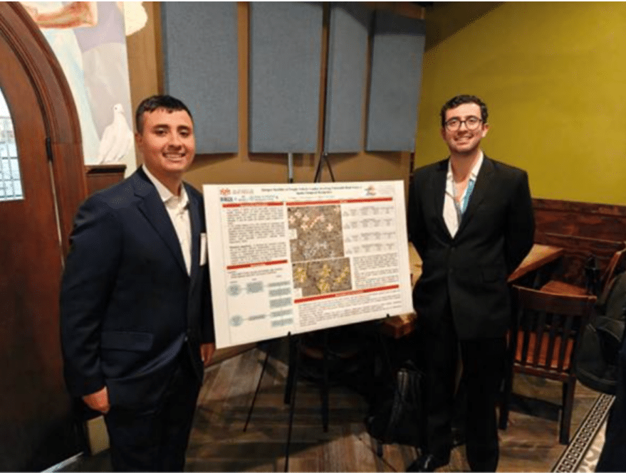
]]>Representing the Gerald May Department of Civil, Construction, and Environmental Engineering at the University of New Mexico (UNM) and the Center for Pedestrian and Bicyclist Safety (CPBS), our team shared our work at the poster session. Alongside other student researchers, we demonstrated how high-resolution INRIX data can inform real-world transportation safety and policy decisions.
The 2025 INRIX x MetroLab Challenge is a partnership that brings together students, researchers, public agencies, and transportation experts to explore how data-driven analysis can be translated into actionable insights for improving urban mobility and public decision-making. For our team, the 2025 INRIX x MetroLab Challenge provided a valuable platform to showcase research focused on a pressing safety issue: understanding where crashes involving freight vehicles and vulnerable road users (VRUs) cluster and how those patterns evolve.
Studying Freight: VRU Safety in a High-Risk Context
We chose this project because it sits at the intersection of freight transportation, safety, and public policy, while addressing a growing public health concern in the U.S.: road traffic trauma, particularly for pedestrians and bicyclists. This issue is especially critical in New Mexico, where VRU risk remains among the highest nationwide. This issue is especially relevant in New Mexico, where VRU risk is among the highest nationwide, underscoring the need to understand how freight activity and VRU exposure overlap on the network.
A key finding from our analysis is that fatal crash hotspots involving freight vehicles and VRUs tend to occur on road segments with substantially higher ADT than hotspots for injury or non-injury crashes, highlighting a strong relationship between crash severity and exposure. In Albuquerque, we also observed that crash hotspot locations tend to exhibit higher average median speeds than non-hotspot areas, suggesting that operating speed may play a role in shaping risk at freight and VRU intersections. Finally, by distinguishing hotspots that are emerging, persistent, or decreasing over time, our results provide decision-makers with actionable insight into where intervention urgency may be greatest.
Leveraging INRIX Data to Move Beyond Crash Counts
The most valuable INRIX resource for our research was the network-level performance indicators, which allowed us to characterize operating conditions on the roadway system, particularly Average Daily Traffic (ADT) as an exposure measure and speed indicators as an operational measure. These datasets were essential because they enabled us to move beyond identifying where crash hotspots occur and instead quantify the underlying conditions of the network segments associated with different hotspot types.
We were particularly struck by the presence of a noticeable number of new hotspots, which indicate locations where crashes increased most recently (i.e., in the last year of the analysis window). This was striking because it suggests that risk is not only persistent in specific corridors but can also emerge quickly.
Insights That Emerged Through Mapping Risk
One of the most surprising takeaways was not that the main findings were counterintuitive; many of the strongest relationships, such as higher exposure being associated with more severe outcomes, align with what we would expect. However, it was how clearly the spatial and temporal structure of risk emerged once we mapped it. In particular, seeing hotspots concentrate in distinct urban contexts, and how those patterns differed when comparing statewide results to the Albuquerque network.
We were particularly struck by the presence of a noticeable number of new hotspots, which indicate locations where crashes increased most recently (i.e., in the last year of the analysis window). This was striking because it suggests that risk is not only persistent in specific corridors but can also emerge quickly.
From Research to Policy-Relevant Applications
As part of the CPBS, we focus our research on ensuring that findings translate into actionable guidance for practice. This research will produce a report and a series of presentations to the public sector and academia to disseminate the research results. The most immediate application of the research is providing agencies with a clear, defensible way to identify where freight–VRU crashes concentrate and how those concentrations behave over time, whether hotspots are emerging, persistent, or diminishing, which helps prioritize locations based on the urgency of intervention rather than only historical totals.
By pairing hotspot classifications with network indicators such as ADT and median speed, we included operational and exposure context that supports more targeted countermeasure selection and corridor-level strategies. These key stakeholders, such as state and local transportation agencies, metropolitan planning organizations, traffic engineering and active transportation teams, and broader safety partners involved in enforcement and public health, prioritize locations based on urgency and risk dynamics, rather than relying solely on historical crash totals.
Looking Ahead
The feedback we received at the 2025 INRIX x MetroLab Challenge emphasized the value of combining spatiotemporal hotspot analysis with network performance data to make safety insights more actionable for practitioners. Several conversations focused on the need for agencies to move from “interesting patterns” to clear corridor-level guidance, including which corridors should be prioritized and the rationale behind those priorities.
For next steps, we plan to link hotspot locations to socioeconomic and built-environment contexts using U.S. Census data to understand the correlation between socioeconomic characteristics and hotspot behavior. In addition, through CPBS’s collaboration with the University of Tennessee, we plan to replicate this workflow in Tennessee and the Nashville metropolitan region, enabling cross-region comparisons and strengthening the broader applicability of the methods. Presenting and researching for the 2025 INRIX x MetroLab Challenge reinforced the impact that data-driven research can have on real-world transportation policy.
Learn more and apply here for the 2026 INRIX x MetroLab Challenge.
The post Turning Data into Action: Advancing Freight and Vulnerable Road User Safety Through the 2025 INRIX x MetroLab Challenge appeared first on INRIX.
]]>The post Regulation Meets Innovation: Using Data to Guide Autonomous Mobility appeared first on INRIX.
]]>Regulatory frameworks remain fragmented; infrastructure readiness varies, and cities need visibility into how AVs will impact congestion, safety, and curb usage. In this uncertain landscape, data has become the most powerful tool for building confidence and coordination. That’s where INRIX comes in.
The Challenge: Complex Roads, Unclear Rules
Despite rapid technological progress, many jurisdictions still lack clear standards for AVs. Some areas allow limited autonomous testing, while others are still defining safety reporting and liability requirements.
Cities face their own hurdles: integrating AVs into mixed traffic, managing curbs and parking zones, and ensuring that AV fleets don’t disrupt public transit or pedestrian safety. Without consistent data and oversight, regulators can’t assess performance, and developers can’t prove their systems are safe. Both need a shared foundation of reliable, real-time mobility data.
How INRIX Supports AV Developers
INRIX delivers real-world data from billions of daily sources of connected vehicles, mobile devices, and road sensors providing AV developers with a scalable, high-fidelity understanding of traffic conditions, hazards, and network dynamics.
- Operational Intelligence: INRIX AI Traffic offers real-time and predictive insights across entire road networks, helping AVs plan routes, avoid congestion, and react to hazards earlier.
- Road-Rules Compliance: The INRIX Road Rules platform translates city traffic laws, turn restrictions, school zones, loading areas into machine-readable data, ensuring AVs operate safely within local regulations.
- Connected-Vehicle Insights: With new OEM data integration, developers can validate performance and benchmark algorithms using live driving data from real vehicles on real roads.
Together, these tools enable AV companies to accelerate deployment, validate safety, and demonstrate compliance to regulators and the public.
How INRIX Empowers Cities
For cities, the transition to autonomous mobility is about more than allowing new vehicles; it’s about governing and monitoring them intelligently.
- Pre-Deployment Planning: INRIX Trip Analytics and INRIX Speed Distribution Profiles help identify corridors best suited for AV pilots based on traffic stability and pedestrian density.
- Network Monitoring INRIX Signal Analytics provides intersection-level visibility, allowing cities to measure how AVs affect traffic flow and signal timing.
- Safety Oversight: Incident and rule-compliance data enable regulators to audit AV performance and ensure safe integration into existing road systems.
- Curb & Parking Management: INRIX Curb Analytics helps cities adapt curb policies as AVs shift from parking to pickup/drop-off zones.
- Transparency & Trust: Shared data allows agencies to communicate measurable safety and mobility improvements, strengthening public confidence.
The Road Ahead
Transparency and collaboration are critical to building public trust as autonomous vehicles move from pilot programs to everyday reality. Success will depend not only on technological advancement, but on accountability and clear communication between innovators and regulators. By delivering neutral, real-time mobility intelligence, INRIX empowers developers to validate safety and compliance while equipping cities to plan and govern responsibly.
To learn more about our products visit inrix.com/products/.
The post Regulation Meets Innovation: Using Data to Guide Autonomous Mobility appeared first on INRIX.
]]>